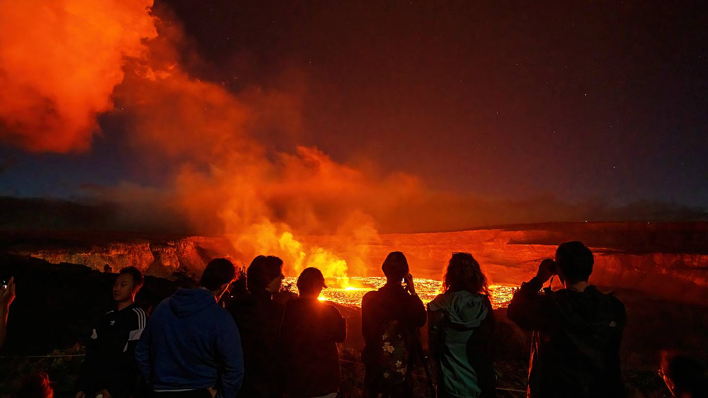
Volcano trails are where hiking gets a little dramaticin the best possible way. One minute you are walking through a forest, the next you are standing on a lava field that looks like the moon forgot to clean up after itself. These are not just ordinary paths with nice views and a few photogenic squirrels. Volcano hiking trails take you through craters, cinder cones, steaming vents, lava flows, obsidian fields, glaciers, and landscapes that remind you Earth is very much still under construction.
The United States is loaded with volcanic landscapes, from the active vents of Hawaiʻi to the snowy Cascade peaks of Washington and California. Some trails are short and family-friendly. Others are thigh-burning climbs that make your legs file a formal complaint. But each one offers something rare: a chance to walk through geologic history while seeing how fire, ash, ice, rain, plants, and time reshape the planet.
Below are 10 fascinating volcano trails worth adding to your adventure list. They are real, scenic, scientifically interesting, and wildly different from one another. Pack water, check current conditions before you go, stay on marked paths, and never underestimate a volcano simply because it is being quiet. Volcanoes are like cats: mysterious, beautiful, and not always interested in your plans.
Why Volcano Trails Are So Fascinating
Volcano trails combine outdoor adventure with natural science. A regular mountain trail may reward you with a summit view, but a volcano trail can show you how a mountain was born, exploded, collapsed, cooled, and slowly returned to life. You might see black basalt, red cinders, steaming fumaroles, lava tubes, mineral-stained pools, or hardy plants growing in cracks where nothing should reasonably be volunteering to live.
These trails also remind hikers that landscapes are not fixed. A lava flow that once destroyed a forest may later become the foundation for new ferns, flowers, birds, insects, and trees. A crater that looks silent today may have erupted within living memory. A glacier-covered volcano may appear peaceful from a meadow trail, while scientists continue monitoring it for earthquakes, deformation, gas, and other signs of activity.
1. Kīlauea Iki Trail Hawaiʻi Volcanoes National Park, Hawaii
Kīlauea Iki Trail may be one of the most unforgettable volcano hikes in America. The route descends from lush rainforest into the floor of Kīlauea Iki Crater, where a lava lake formed during the famous 1959 eruption. It is the kind of hike where your brain keeps switching channels: tropical jungle, black crater floor, steam vents, cinder cone, open sky, and then back to jungle again.
The trail is often described as a loop with access from the Kīlauea Visitor Center area. Depending on the route chosen, hikers can expect several miles of walking and a moderate effort. The highlight is crossing the hardened lava lake. It feels strange in the best waylike walking across a frozen storm. Cracks, textures, and subtle heat reminders make the ground feel alive, even though the surface is solid.
This is a top volcano trail for hikers who want a powerful mix of scenery and eruption history. It is not just pretty; it tells a story. In 1959, lava fountains reached astonishing heights, and today visitors can stand inside the aftermath. That is not something your neighborhood walking path can offer, unless your neighborhood is unusually spicy.
2. Maunaulu / Puʻuhuluhulu Trail Hawaiʻi Volcanoes National Park, Hawaii
Maunaulu is a lava landscape created by the 1969–1974 eruption on Kīlauea’s East Rift Zone. This trail introduces hikers to lava tree molds, rough flows, open volcanic terrain, and the forested cinder cone of Puʻuhuluhulu. The contrast is striking: black lava stretching outward while green life reclaims whatever space it can negotiate.
The hike is especially fascinating because it shows a relatively recent eruption landscape in the process of recovery. You can see where lava moved through old forest, where trees were burned away, and where molds remain like ghostly signatures in stone. The climb up Puʻuhuluhulu adds a rewarding viewpoint, with possible views of Maunaulu, Mauna Loa, Mauna Kea, and the Pacific Ocean on clear days.
For travelers who love geology but do not want a brutal all-day expedition, Maunaulu is a superb choice. It feels remote and otherworldly without requiring mountaineering skills. Bring sun protection, water, and curiosity. The lava field has a way of making you ask big questions, such as “How old is this flow?” and “Why did I wear black socks in the Hawaiian sun?”
3. Keoneheʻeheʻe Trail, also called Sliding Sands Haleakalā National Park, Maui
Keoneheʻeheʻe Trail, commonly known as Sliding Sands, drops into the vast summit wilderness of Haleakalā. This is one of the most surreal volcano trails in the United States. The colors shift from rust to gold to charcoal. Cinder cones rise like giant scoops of powdered earth. Clouds may drift below you. The whole place feels like a dream sequence directed by a geologist with excellent taste.
Many visitors walk only to the first overlook, while experienced hikers may continue deeper into the crater or combine the route with the Halemauʻu Trail for a longer full-day trek. The important thing to remember is that the trail descends first. That means the return hike climbs back up at high elevation, and Haleakalā does not care how inspirational your vacation playlist is.
Sliding Sands is best for hikers who want scale, silence, and a landscape unlike nearly anywhere else. It is not flashy in the tropical postcard sense. Instead, it is spacious, strange, and meditative. Every footstep feels like moving through a volcanic amphitheater where the seats are cinder cones and the stage lighting is pure Maui sky.
4. Lassen Peak Trail Lassen Volcanic National Park, California
Lassen Peak Trail is a strenuous but rewarding climb to the summit of one of the largest plug dome volcanoes in the world. The trail is about five miles round trip and gains nearly 2,000 feet of elevation, starting high and going higher. Translation: your lungs will notice the scenery before your camera does.
The reward is a sweeping view across Lassen Volcanic National Park, where multiple types of volcanoes, hydrothermal areas, lakes, forests, and mountain ridges share the same dramatic stage. Lassen Peak erupted between 1914 and 1917, with a powerful explosion in 1915 that helped shape the park’s identity. Hiking here is not just a summit walk; it is a climb up a volcano with a relatively recent eruptive past.
This trail is best for fit hikers who want a classic volcano summit experience without technical climbing in normal summer conditions. The surface can include loose rock, and snow may linger into the season, so checking current trail conditions is essential. Start early, bring layers, and expect wind near the top. Volcano summits do not believe in gentle hair days.
5. Bumpass Hell Trail Lassen Volcanic National Park, California
Bumpass Hell Trail is the place to go if you want your volcano hike to hiss, bubble, steam, and smell faintly like the Earth is boiling eggs for breakfast. This trail leads to the largest hydrothermal area in Lassen Volcanic National Park, where fumaroles, boiling springs, mud pots, and mineral-stained ground create a dramatic geothermal basin.
The route is commonly listed as about three miles round trip from the Bumpass Hell parking area, with a descent into the basin after a gradual approach. Boardwalks protect both visitors and the delicate, dangerous ground. That is not decoration; it is survival advice with railings. Hydrothermal crust can be thin, hot, and unstable.
Bumpass Hell is fascinating because it shows that volcanic activity is not only about eruptions and lava. Heat beneath the surface continues to interact with groundwater, producing steam and acidic features. The result is beautiful, strange, and slightly villain-lair-ish. Stay on the trail, follow closures, and resist any urge to test the ground. The volcano already passed chemistry class. You do not need to participate.
6. Monitor Ridge Route Mount St. Helens, Washington
Mount St. Helens is one of the most famous volcanoes in the United States, and the Monitor Ridge Route is the primary summer route used by climbers heading to the summit. This is not a casual stroll. It is a strenuous, non-technical scramble that gains about 4,500 feet in roughly five miles one way, with many climbers taking seven to 12 hours round trip.
The route begins near Climbers Bivouac and moves through forest before reaching rougher volcanic terrain. Higher up, hikers encounter boulder fields, ash, pumice, and wide-open exposure. The summit view into the crater is unforgettable: a raw reminder of the 1980 eruption that reshaped the mountain, surrounding forests, river valleys, and public understanding of volcanic power.
A climbing permit is required year-round, and conditions vary dramatically by season. In snow or ice, the route becomes a mountaineering objective requiring proper equipment and skills. In summer, it is still physically demanding. But for prepared hikers, Monitor Ridge is a bucket-list volcano trail with emotional impact. You do not simply see volcanic destruction and recoveryyou stand on the edge of it.
7. Lava Flow Trail Sunset Crater Volcano National Monument, Arizona
Lava Flow Trail at Sunset Crater Volcano National Monument is a fantastic option for hikers who want volcanic drama without committing to an all-day trek. The trail explores the Bonito Lava Flow, a rugged landscape created by Arizona’s most recent volcanic eruption, which occurred roughly 1,000 years ago.
This area is especially good for families, curious beginners, and anyone who wants to learn volcanic terms while actually seeing examples on the ground. Depending on the route and current access, visitors may encounter cinders, basalt, squeeze-ups, lava features, and views of Sunset Crater itself. The black lava against ponderosa pine forest makes the landscape feel both harsh and surprisingly beautiful.
The fascinating part is the contrast between destruction and renewal. Lava once buried the area, yet today plants and wildlife have returned. The trail is a reminder that nature does not erase disasters overnight, but it does keep working. Slowly. Patiently. With far better long-term planning than most humans bring to assembling camping gear.
8. Big Obsidian Flow Trail Newberry National Volcanic Monument, Oregon
The Big Obsidian Flow Trail at Newberry National Volcanic Monument is short, sharp, shiny, and unforgettable. This one-mile interpretive trail climbs onto Oregon’s youngest lava flow, a striking mix of black volcanic glass and pale pumice. It looks like someone shattered a giant mirror, mixed it with moon gravel, and spread it across the forest.
Obsidian forms when silica-rich lava cools quickly, creating natural volcanic glass. Along this trail, hikers can see huge chunks of glossy black rock, rough pumice, and views across Newberry Caldera. It is one of the best places in the country to experience obsidian in the landscape rather than behind museum glass.
The trail is moderate despite its short length because the footing can be uneven and the volcanic material is sharp. Stay on the established route and do not collect rocks. The obsidian belongs to the landscape, and frankly, it has been through enough. This trail is perfect for geology lovers, photographers, families with careful walkers, and anyone who enjoys hikes that feel like stepping into Earth’s workshop.
9. Capulin Volcano Crater Rim Trail Capulin Volcano National Monument, New Mexico
Capulin Volcano Crater Rim Trail is a paved one-mile loop around the rim of an extinct cinder cone in northeastern New Mexico. Do not let the short distance fool you. The trail includes steep climbs and descents, and the elevation makes things feel sportier than the mileage suggests.
The big reward is the view. From the rim, hikers can look across the Raton-Clayton Volcanic Field and, on clear days, see into multiple states. Interpretive signs help explain the surrounding volcanic features, making this a compact but information-rich hike. It is the kind of trail where you can learn a lot in an hour and still have time for snacks, which is basically the dream.
Capulin is especially appealing because it lets visitors stand on the rim of a classic cinder cone without needing a huge expedition. The crater, the slopes, the prairie, and the distant volcanic landscape all fit together like a geology diagram that escaped the textbook and became a hiking trail.
10. Skyline Trail Mount Rainier National Park, Washington
The Skyline Trail at Mount Rainier is not a crater-floor hike or a lava-field scramble. It is a volcano trail in a grand alpine sense: a route through subalpine meadows beneath one of the most iconic active stratovolcanoes in North America. Mount Rainier rises to 14,410 feet, carries massive glaciers, and dominates the Washington skyline with the calm confidence of a mountain that knows everyone is taking its picture.
The main Skyline loop from Paradise is often listed around 5.5 miles with significant elevation gain, though shorter options are available, including the paved walk toward Myrtle Falls. In summer, wildflowers can be spectacular. Views may include the Nisqually Glacier, Tatoosh Range, and distant Cascade volcanoes on clear days.
What makes this trail fascinating is the combination of beauty and hazard. Rainier is heavily glaciated, and volcano scientists pay close attention to the mountain because laharsvolcanic mudflowsare a major concern in surrounding valleys. On the trail, however, the experience is often peaceful: marmots, meadows, waterfalls, snowfields, and that enormous white volcano filling the sky. It is a reminder that volcanoes can be dangerous, gorgeous, and deeply loved all at once.
How to Choose the Right Volcano Trail
The best volcano trail depends on your fitness, travel style, and comfort with elevation or exposure. For an easier introduction, consider Lava Flow Trail at Sunset Crater, Capulin’s Crater Rim Trail, or portions of Maunaulu. For a moderate adventure with big scenery, Kīlauea Iki and Big Obsidian Flow are hard to beat. If you want a serious challenge, Lassen Peak and Monitor Ridge will happily introduce your calves to their life choices.
Families may prefer shorter interpretive trails with clear signage and reliable turnaround options. Photographers may love Sliding Sands, Skyline Trail, and Big Obsidian Flow for their color and texture. Geology enthusiasts should prioritize Kīlauea Iki, Maunaulu, Bumpass Hell, and Sunset Crater because these trails make volcanic processes visible in a direct, memorable way.
Volcano Trail Safety Tips
Before hiking any volcano trail, check official park or forest alerts. Volcanic landscapes change quickly because of weather, snow, rockfall, gas, heat, erosion, and closures. Trails in high-elevation parks may remain snow-covered well into summer. Hydrothermal areas can be dangerous even when they look calm. Active volcanic areas may have toxic gases, unstable ground, or sudden closures.
Stay on marked trails, carry enough water, bring sun protection, and wear sturdy shoes. Lava rock can be sharp, cinders can roll underfoot, and volcanic glass is not something you want arguing with your sandals. At high elevations, pace yourself and watch for signs of altitude stress. In exposed areas, wind and weather can shift quickly. The goal is to come home with photos, stories, and maybe a little dustnot a rescue report.
Experiences That Make Volcano Trails Unforgettable
Hiking a volcano trail is different from simply visiting a scenic overlook. The experience builds slowly through your senses. First comes the color: black lava, red cinder, yellow sulfur, green ferns, white snow, blue sky. Then comes the texture: crunching pumice under boots, smooth obsidian shining in the sun, rough basalt that looks like it cooled five minutes ago. Even the silence can feel different, especially inside a crater or across a barren lava field where the usual forest sounds fade away.
One of the most memorable experiences is walking across a lava field and realizing that the ground beneath your boots was once liquid rock. On trails like Kīlauea Iki or Maunaulu, the landscape feels recent, not ancient. Cracks, vents, and hardened waves of lava make the past feel close enough to touch. It is humbling in a way that ordinary hiking rarely is. You are not just moving through nature; you are moving across the evidence of creation and destruction happening in the same breath.
Another unforgettable moment comes on high volcano trails when the view suddenly opens. On Lassen Peak, Mount Rainier’s Skyline Trail, or the upper parts of Monitor Ridge, the world expands fast. Forests become patterns. Lakes become flashes of blue. Other volcanoes appear on the horizon like sleeping giants lined up for roll call. These views help hikers understand volcanic regions as systems, not isolated peaks. A single volcano may dominate the scene, but it belongs to a much larger story of plate tectonics, magma, uplift, erosion, and time.
Volcano trails also create a strange emotional mix. They can be peaceful and intimidating at once. Bumpass Hell may be beautiful, but the steam and boiling water make it clear that the ground is not passive. Mount St. Helens may be breathtaking, but the crater is a visible reminder of loss, force, and recovery. Sunset Crater may feel quiet today, yet its lava flow changed the lives of people who lived nearby centuries ago. These hikes invite awe, but they also ask for respect.
The human side of volcano hiking is just as memorable. Someone in every group will underestimate the sun. Someone will say, “It’s only one mile,” right before a steep paved volcano rim teaches them humility. Someone will take 47 photos of the same lava rock because, honestly, it does look different from every angle. And someone will read an interpretive sign out loud with the seriousness of a documentary narrator. These are the small moments that turn a trail into a story.
For first-time volcano hikers, the best approach is to slow down. Read the signs. Notice the plants growing from cracks. Look for differences between older and newer flows. Pay attention to how the trail surface changes. Ask why one area has trees and another is still bare. Volcano trails reward curiosity. They are outdoor classrooms, but without fluorescent lights, uncomfortable chairs, or that one person who asks a question two minutes before lunch.
The lasting experience is perspective. Volcanoes remind us that Earth is not finished. Mountains rise, collapse, erupt, erode, and bloom again. Trails cross places that were once dangerous, barren, or buried, and yet life returns. Hiking through these landscapes can make everyday worries feel smallernot because they do not matter, but because the planet is operating on a scale that stretches far beyond our schedules. A volcano trail gives you exercise, scenery, science, and a gentle reminder that change is not always the end of a story. Sometimes it is the beginning of the next landscape.
Conclusion
The 10 fascinating volcano trails above prove that hiking can be more than fresh air and pretty views. It can be a journey through eruption history, living geology, ecological recovery, and some of the most dramatic landscapes in the United States. From the lava lake of Kīlauea Iki to the obsidian glass of Newberry, from the steam of Bumpass Hell to the glacier-framed meadows of Mount Rainier, each trail shows a different personality of volcanic terrain.
Whether you want an easy interpretive walk or a demanding summit climb, volcano trails offer adventure with meaning. They are beautiful, educational, unpredictable, and occasionally rude to your quadriceps. Choose the trail that matches your ability, check conditions, respect closures, and let the landscape do what it does best: make you feel small, amazed, and very glad you brought snacks.